|
| ISLANDS A-Z | CRETE | CYCLADES | DODECANESE | EASTERN AEGEAN |
| IONIAN | SARONIC | SPORADES | MAINLAND | ABOUT US |
Hiking in Amorgos |
|
|
There are not many islands that suites so good for hiking like Amorgos. It is one of my personal favourite hiking islands, together with Ikaria, Kea, Crete, Nisyros and Sifnos. I can even go so far as to appoint Amorgos to number one.
Hiking map of Amorgos.
Sure, Crete offers much more spectacular hikes and cool ravines, but I still like the hikes more on Amorgos than in Crete. The reason is, besides the magnificent scenery, that the trails usually begins and ends in a village, it's not bad to arrive to a cosy village taverna after a few hours in the mountains. The knowledge of that a cold beer is waiting for you is not entirely wrong as a driver when it starts to feel strenuous.
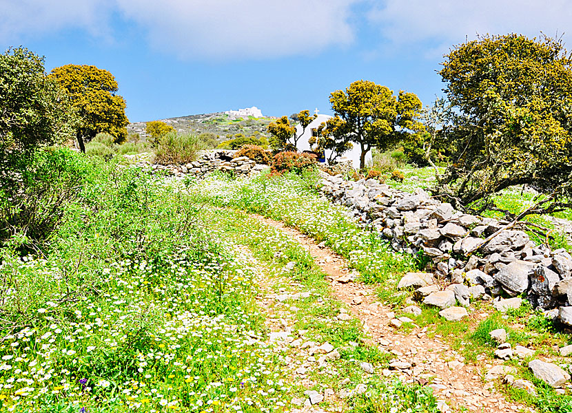
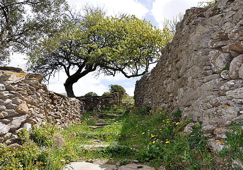
The hike between Langada and Agios Theologos.
Read about the hike to Agios Theologos Monastery here »There are several hiking trails around the island where you have the opportunity to meet the great silence and at the same time be dumbfounded by the breathtaking views. There are four longer hikes that are marked out with numbers, and many shorter hikes. All hikes can be shortened or made longer, if desired.
To me, the best hikes are: Katapola-Vroutsi-Arkesini
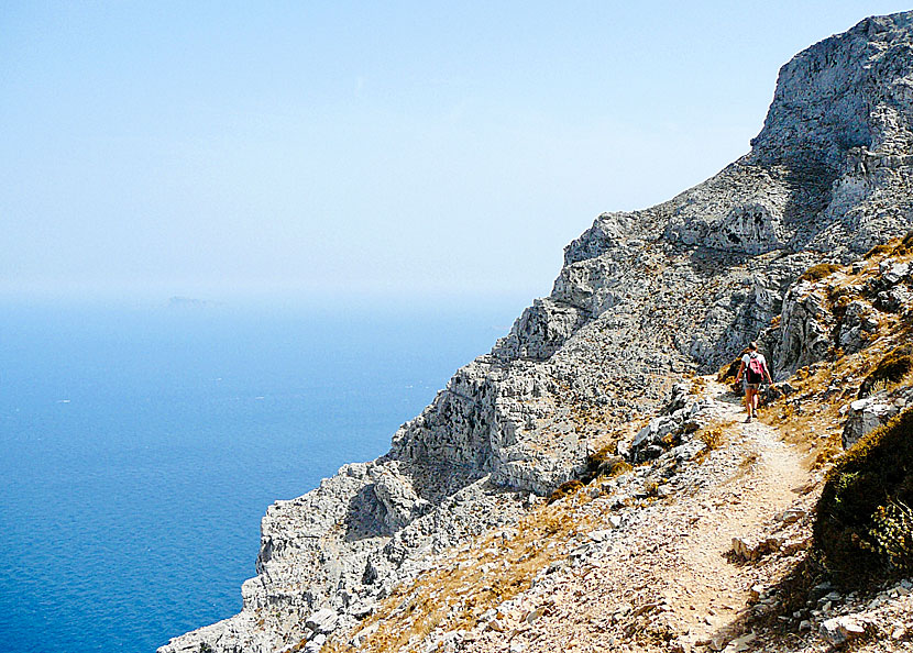
I recommend the hike to Stavros only to very experienced hikers.
Pictures from the hike to Stavros church can be found here » |
The hike between Katapola and Chora is easy and very beautiful.
Read about the hike between Katapola and Chora here »
For the inexperienced hiker, I recommend the following: Langada-Agios Theologos and back again
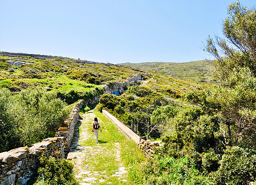
The end of the hike from Panagia Hozoviotissa to Aegiali.
When you feel ready for longer tours you can challenge yourself and hike the trail between the monastery of Panagia Hozoviotissa and Aegiali. A first-rate experience high in the mountains, you will be dumbfounded by the views. I promise! On one of the hike's highest points, you pass the uninhabited village of Asfontilitis where you can study some rock carvings. Nearby the village there is a small taverna that opened in 2014. If you are going to hike on Amorgos I recommend Anavasi's blue map (1: 32,000), which describes many hikes on the island. Terrain maps (also called Skai Maps) is another Greek cartographic company specialized in hiking maps. They have a map of Amorgos with the scale 1:35,000, and it also describes many hikes. Both maps are available for purchase on the island.
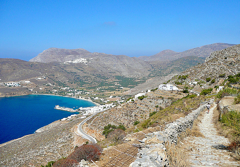
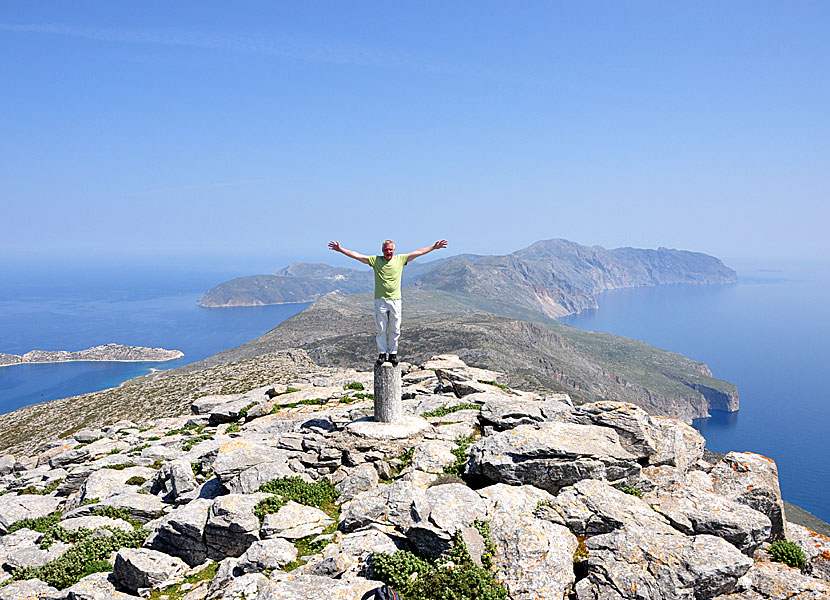 If you hike to Profitis Ilias, you have the whole Amorgos under your feets.
To the bottom left in the pricture you see the island Nikouria and beach of Agios Pavlos. Under my right arm you see the village Tholaria.
Read more about the hike to Profitis Ilias here »
|
READ MORE ABOUT AMORGOS |
||||||
| About Amorgos | Getting here | Getting around | Villages | Beaches | Sights | Hotels |
HOME |
ABOUT US |
SEARCH |
BOOK HOTEL |
GREEK ISLANDS |
SWEDISH
|
|
© 2007-2026 | Janne Eklund | Kalispera and Kalimera. |