 |
| ISLANDS A-Z | CRETE | CYCLADES | DODECANESE | EASTERN AEGEAN |
| IONIAN | SARONIC | SPORADES | MAINLAND | ABOUT US |
Hiking in Koufonissi |
|
The flat landscape, the lack of longer paths and the minimal area makes experienced hikers come away empty-handed on Koufonissi. The simply fact is that it is a lousy hiking island, which in itself is a paradox, if you do not walk, if ever so little, you will come nowhere. Aside from the path along the coast, and the concrete road between Chora and Pori, there are not many other paths to follow.
Walking around Koufonissi does not take much more than 2 hours, if you walk at a slow pace.
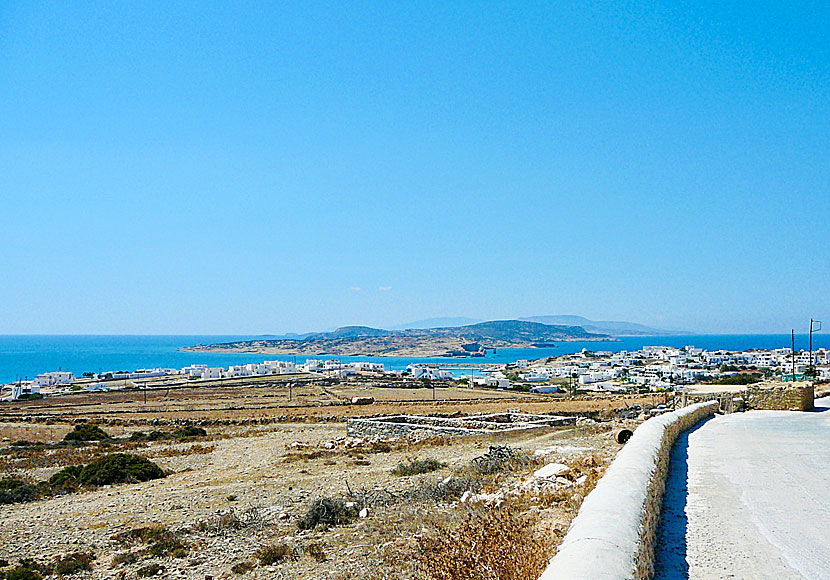
 Koufonissi´s only road runs between Chora and Pori beach. Kato Koufonissi in the background.
One alternative is the road that goes around the village through the port, you will then arrive in Loutro, a small bay with a windmill and a few tavernas. You can also reach Loutro if you follow the main road through the village until it ends. From Loutro, you can continue to the next bay called Parianos, usually the fishermen anchor their fishing boats here when it is stormy weather. If you round the bay, you can continue on smaller goat tracks a little bit along the coast.
The small port Parianos with Naxos in the background. |
|
The best hiking map of Koufonissi is published by the Greek cartographic company Terrain maps, also called Skai Maps. The scale is 1:25,000 and can be purchased on Koufonissi. The map describes the best hiking routes on the islands of the Small Cyclades: Donoussa, Iraklia, Koufonissi and Schinoussa.
The path that goes between Finikas beach and Fanos beach.
If you walk along the coast you pass the lagoon Devil's Eye.
The hike to Galas beach ends here. |
READ MORE ABOUT KOUFONISSI |
||||||
| About Koufonissi | Getting here | Getting around | Villages | Beaches | Sights | Hotels |
HOME |
ABOUT US |
SEARCH |
BOOK HOTEL |
GREEK ISLANDS |
SWEDISH
|
|
© 2007-2026 | Janne Eklund | Kalispera and Kalimera. |